This multi-media website is devoted to documenting and narrating the story of Shell’s pioneering development of the Mars field in the deepwater Gulf of Mexico (3,000 feet of water), as well as associated fields the greater Mars-Ursa basin. The narratives, photos, videos, and other resources gathered here offer insight into the decisions and dramas that made the Mars-Ursa complex one of the most vital American energy assets. This project also provides a forum for “Martians” and other participants to contribute recollections, images, or artifacts, which will help to preserve the living history and memory of Shell’s Deepwater Mission to Mars. Research for this project was sponsored by a cooperative agreement between the C.T. Bauer College of Business at the University of Houston and the Bureau of Ocean Energy Management (BOEM) of the U.S. Department of the Interior.
The story of deepwater oil in the Gulf of Mexico can be told through the story of Mars, historically the largest single source of crude oil in American waters. It was one of the earliest prospects to be drilled and developed on some of the first federal deepwater leases offered in the early 1980s. In the late 2010s, thirty-five years later, it remains one of the most productive basins in the Gulf at the cutting edge of technology.
More than any other project in the Gulf of Mexico, Mars (and the development of its adjacent fields, Ursa, Europa, Deimos, and West Boreas) documents the wide-ranging innovations that have propelled the industry into ever-deeper waters and new geological frontiers. It provides a window into the evolution of geophysical technology and interpretation, drilling and well completion, platform and facilities design, workforce organization and culture, process engineering, subsea engineering, reservoir engineering, pipelining, project management, disaster management, and safety management. Mars marks the transition from fixed to floating production platforms in deepwater, and from “conventional” deepwater to subsalt deepwater. It also had a starring role in the industry’s recovery from two traumatic disasters, Hurricane Katrina in 2005 and the Deepwater Horizon/Macondo blowout and spill in 2010. Finally, the 2014 installation of a second, state-of-the-art facility, Olympus, in the same field once again placed Mars in the forefront of offshore development.
The purpose of the website is to document, analyze, preserve, and display the history of this American energy asset. It seeks to reveal the intricacies of a leading company’s decisions, investments, and operations in one of the biggest and most technologically innovative industries in the world, and to humanize those who took part in this history. The website provides a forum for “Martians” and other participants to contribute recollections, images, or artifacts which will help to maintain the living history and memory of “Shell Oil’s Deepwater Mission to Mars.” Hundreds of thousands of people have worked directly in the Gulf of Mexico offshore oil industry over time, tens of thousands for Shell, and thousands on the Mars project. Together these people advanced the state of science and technology, not just for the extraction of offshore oil and gas, but also beyond it.
The website features the following resources:
- Two historical essays, one on the history of “Shell Oil’s Deepwater Mission to Mars,” by Tyler Priest; and the other entitled, “The Shape of These Monsters: From Fixed to Floating Offshore Oil and Gas Production, 1976-2006,” by Joel Hewett.
- A 30-year timeline of significant moments in the history of Shell’s greater Mars development.
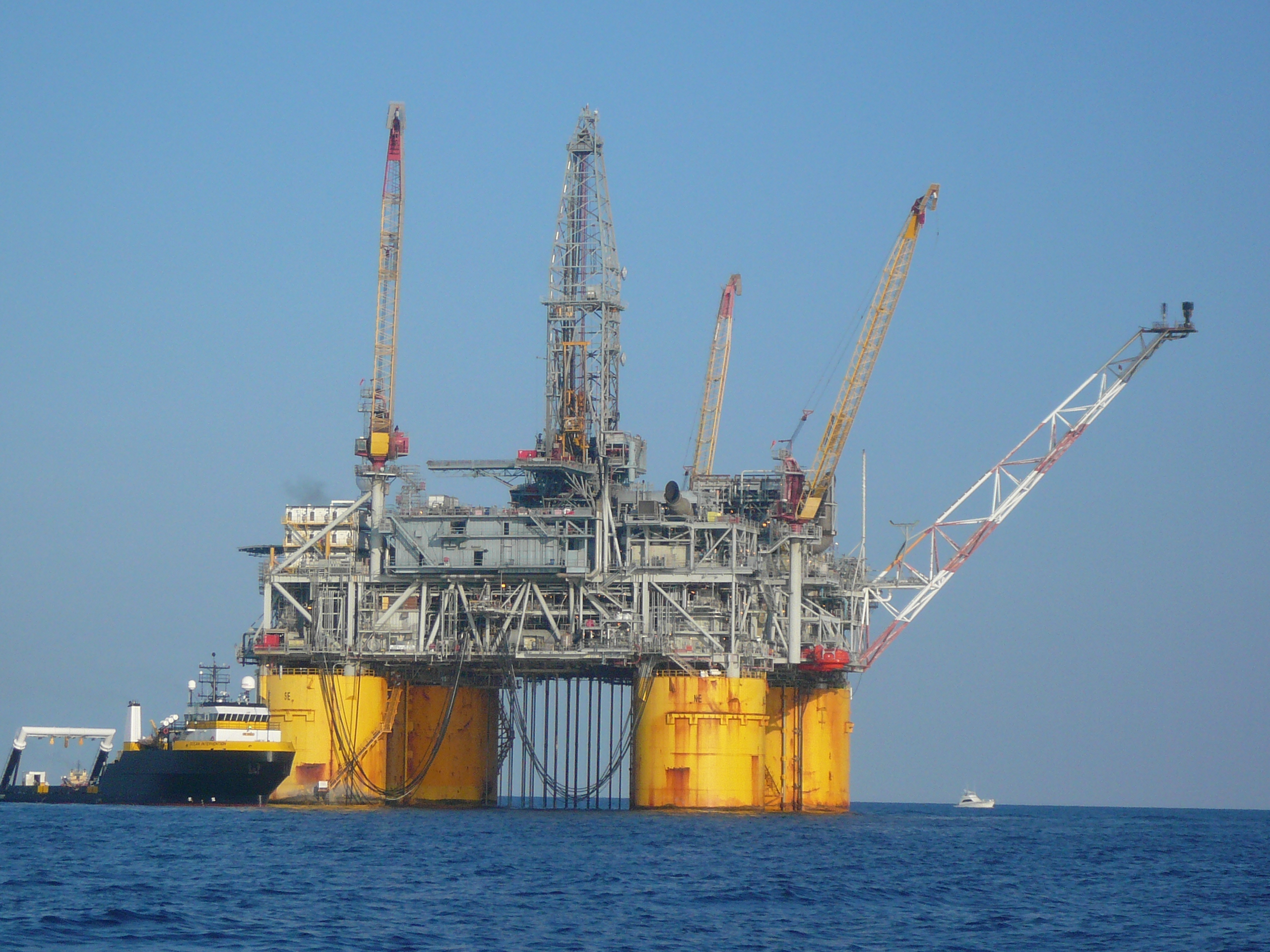
- A photo gallery of the Mars TLP and its people, equipment, and projects.
- A video collection featuring the Mars, Ursa, and Olympus tension-leg platforms, along with many others in the deepwater Gulf of Mexico (more than 80 total).
- A series of graphs that illustrate the evolution of deepwater projects and production in the Gulf of Mexico.
- A series of Gulf of Mexico maps, including: an interactive ArcGIS Gulf of Mexico Map that displays Gulf of Mexico leases, platforms, pipelines, and boundaries; an interactive ArcGIS Deepwater Gulf of Mexico Story Map that highlights 17 major deepwater facilities; and an interactive ArcGIS Onshore Oil and Gas Infrastructure Map that displays onshore, lower-48 U.S. oil and gas infrastructure and its offshore connections.
- A “Martian Stories” site for oral histories and personal recollections.
Images: Shell Oil’s Mars Tension-Leg Platform, Mississippi Canyon, Gulf of Mexico (Jason Theriot)
